
Aerial Views
Title
Aerial Views
Date
To the present
Description
Original aerial photographs & digital copies.
Collection Items
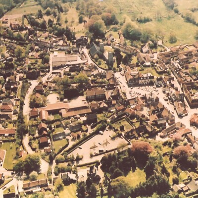
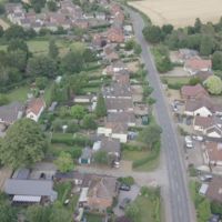
Aerial Views of Reepham, Salle & Booton
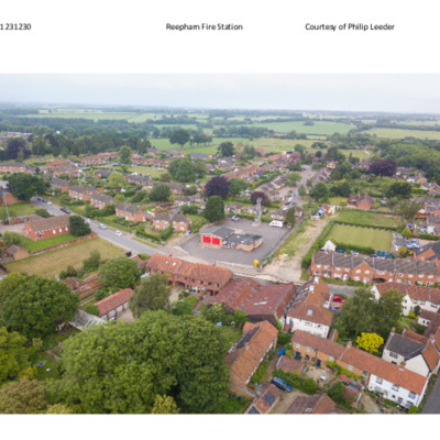
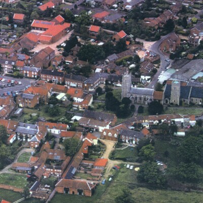
Over 70 views of the Reepham area taken from a drone by Philip Leeder.
Two examples shown here, the remainder can be viewed in Reepham Archive.
Subjects covered include :-
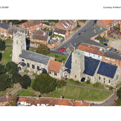
Reepham Churches
Whitwell Station
Station Plain Area
Collers…
Two examples shown here, the remainder can be viewed in Reepham Archive.
Subjects covered include :-
Reepham Churches
Whitwell Station
Station Plain Area
Collers…
Ordnance Survey Photographs
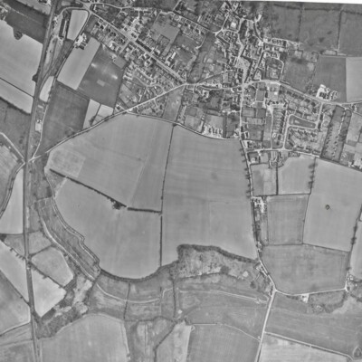
Three undated B&W Ordnance Survey images taken at different times. One shows the beginnings of the Richmond Rise & Bircham Road estates. In the other two the Ollands House is still present and there are still outbuildings on the land that was to…
View from Rookery Farm towards churches
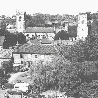
This image is very similar to Item #158 but was taken on another occasion. Also taken from a hoist or cherry picker but the foreground activity is very different.
Three Views of Reepham
Three similar professional quality photographs of Reepham. Taken after the development of Merchants Yard & the Spar supermarket. Abbs Garage still existent as are the buildings behind the Old Brewery House Hotel.
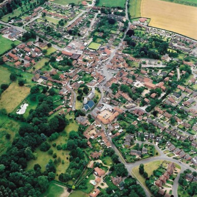
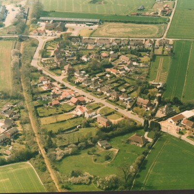
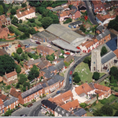
Aerial Views of Reepham
Professional quality aerial views of Reepham by Mike Page. Two examples shown here, the remainder can be viewed in Reepham Archive.Aerial Photographs all copyright [© Mike Page © Reepham] [Google Mike Page for more information]2004 Bircham…
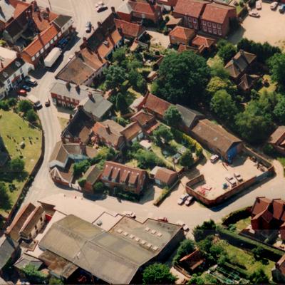
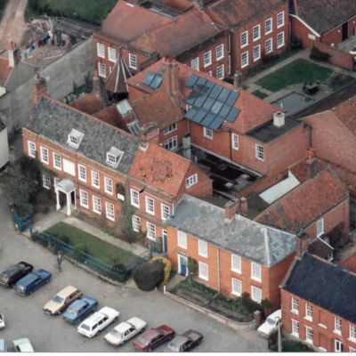
Dial House Development
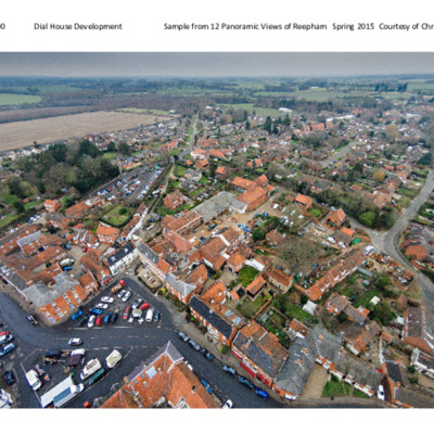
Aerial & wide angle images of Reepham town centre, focusing on the Dial House development in 2015. 12 images prepared for use in The Dial brochure.
Two examples given here from January & April 2015.
The remainder can be viewed in Reepham Archive.
Two examples given here from January & April 2015.
The remainder can be viewed in Reepham Archive.
Cawston Road before B1145 modification
On the left can be seen the start of the Crown Meadow Development, the disused station and storage that later became Kerri's Pine. The railway bridge over Marriott's Way is now a footpath to Coller's Way. Bottom right can be seen Fairway Garage and…
Aerial View of Reepham
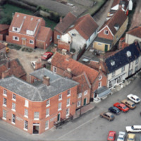
Photograph showing Randell’s workshops and showrooms, now Spar and Malthouse Yard, the site of Wilkins Mills, the Bircham's Brewery and the car park of the Old Brewery House Hotel.
Bircham Centre & Kings Arms
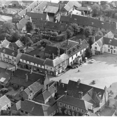
Aerial view of Reepham Market Place showing Bircham Centre, Kings Arms and shops opposite Post Office. "Hardiment's Stores" painted on wall of corner shop.Outside Bircham Centre - white telephone box, no bus shelter.
Market Place
Aerial photograph shows Bank House (Barclays), Butcher's, Chemist's, The Chimes and Merchants Yard behind
Reepham Market Place, north east corner
Aerial photograph shows Chemist's shop, Old Brewery House, Old Bakery and Melton House. Top of Well Head visible.
2020 The chemist's shop was previously the Chimes Antiques premises and is currently a deli/farm shop
2020 The chemist's shop was previously the Chimes Antiques premises and is currently a deli/farm shop
Lower School Road from Rookery Farm
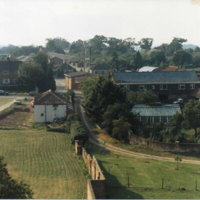
From elevated platform at Rookery Farm looking towards the Fire Station.
Rear entrance drive and gardens of The Oaks Back Street. Driveway and wall works in progress at 45 School Road (The Granary).
Rear entrance drive and gardens of The Oaks Back Street. Driveway and wall works in progress at 45 School Road (The Granary).
Reepham Roofs from south east
Low angle photograph (taken from cherry picker) shows roofs of properties in Back Street, Market Place and beyond. Bircham Centre and Bank Building visible.
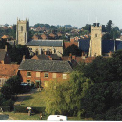
Reepham Churches

Aerial photograph from the north west shows both churches and Back Street & Church Street houses with their rear outbuildings. Building works in progress at York House.
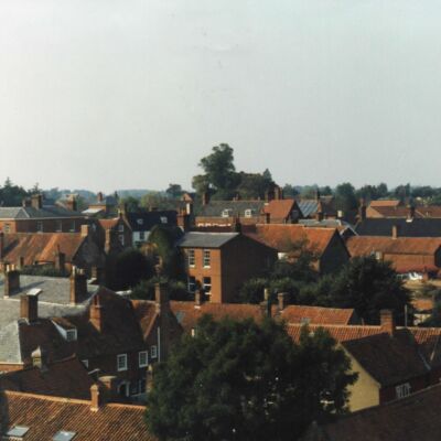
View Over Rooftops
View showing a corner of the Market Place, both churches and Randell's workshops.
Aerial view from Rookery Farm towards churches
Taken from elevated platform (cherry picker) showing the barns to west probably on a summer evening. North of the churches can be seen the roofs of new houses built on the site of Randell's yard.
Collection Tree
- [Unavailable]
- Aerial Views