Browse Items (45 total)
- Collection: Maps
Sort by:
Wood Dalling tithe map, 1841
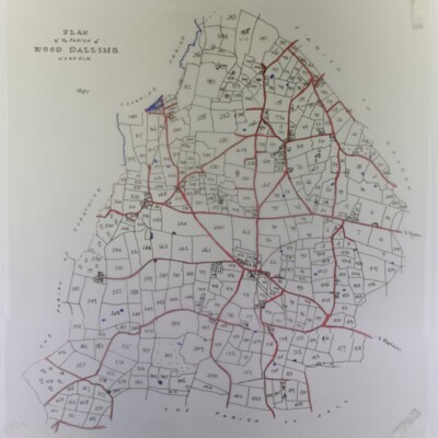
With owners’ list (not found) and slightly reduced tracing
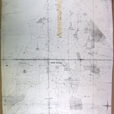
Wood Dalling Ordnance Survey map, 1978
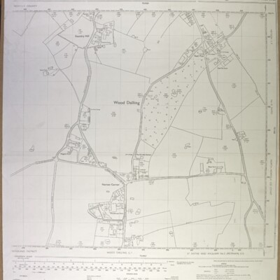
Wood Dalling centre (Norton Corner), Ordnance Survey, 1978, scale 1:2500, ref. TG 0828-0928
Whitwell, tithe map, 1844
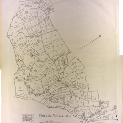
Original (not scanned) and tracing by Kate Nightingale
Whitwell, Ordnance Survey map, 1906, showing Whitwell Hall and Hackford Hall
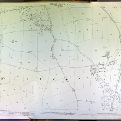
Whitwell, showing Hackford and Whitwell Halls, Ordnance Survey, 1906, scale 1:2500, Norfolk Sheet XXXVIII 9, surveyed in 1891-94, revised in 1905.
Whitwell, Ordnance Survey map, 1906

Ordnance Survey 1906, second edition, scale 1:2500, Norfolk Sheet XXXVIII 10, surveyed in 1891-94, revised in 1905
Whitwell Common, 1905
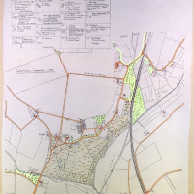
Tracing made by Kate Nightingale made 5 March 1993 of a map belonging to Mr Tony Ivins of Whitwell Hall. See also GB/REE/2108041645, Occupants of Whitwell Common Cottages in 1905 & 1971 by Ann Middlemas
Thurning Ordnance Survey map, 1906, showing Thurning Hall and Tyby
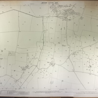
Thurning, Ordnance Survey, 1906, second edition, surveyed in 1884-85, revised in 1905, scale 1:2500, ref. Norfolk Sheet XXVII 9, showing Thurning Hall and Tyby.
Thurning Ordnance Survey map, 1906, showing Thurning Hall and church
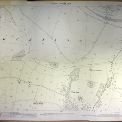
Thurning, Ordnance Survey, 1906, second edition, surveyed in 1885, revised in 1905, scale 1:2500, ref. Norfolk Sheet XXVII 5, showing Thurning Hall and church.
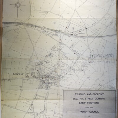
Supply of Electricity to Reepham
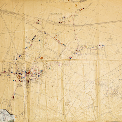
Map printed on linen showing plans for the supply of electricity to properties in Reepham. Shops and houses are marked in colour. Reepham was one of the first rural towns in the country to get electricity.
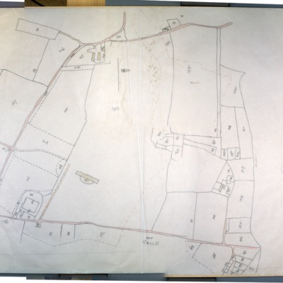
Salle Park, 1978
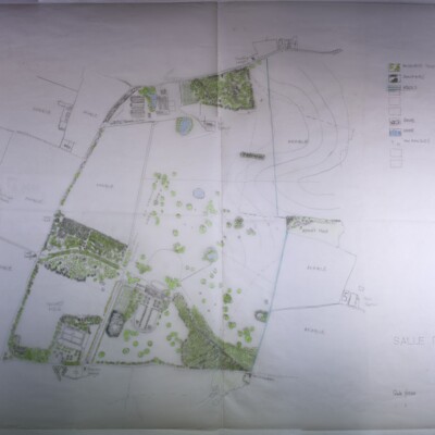
Scale 1/1250
Salle Estate, 1807
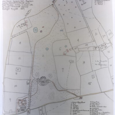
Plan of gardens, house, lands, etc., of Richard Paul Jodrell Jun. Esq. In his own tenure lying in Sall and Reepham and of adjacent allotments upon Sall Common, lately enclosed with lands and tenements adjoining. Surveyed 28 May 1807.
Reepham, Kerdiston, Ordnance Survey map, 1886
Ordnance Survey map, 1886, scale 1:2500, ref. XXXVIII 6
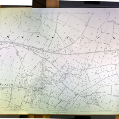
Reepham with Kerdiston, Ordnance Survey map, 1906
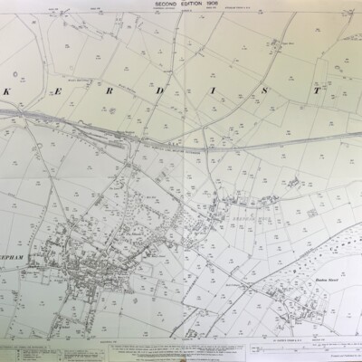
Ordnance Survey, 1906, scale 1:2500, Norfolk Sheet XXXVIII 6, second edition, surveyed in 1884, revised in 1904-05
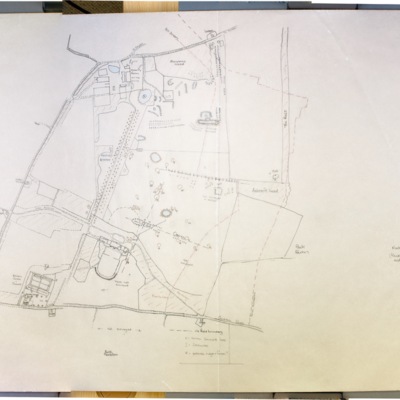
Reepham Village Centre, 1972
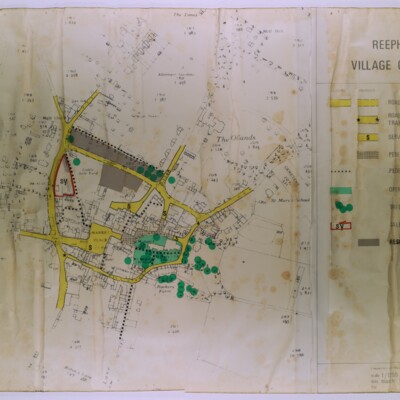
Scale 1:1250
Plan of Reepham Brewery, 1878
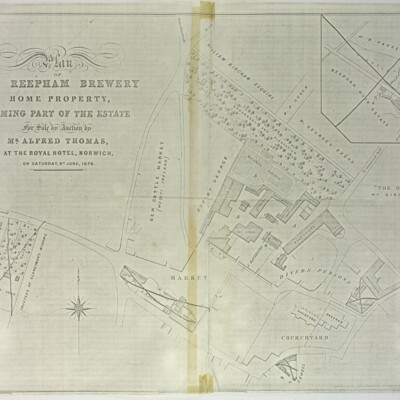
Home property forming part of the estate for sale by auction by Mr Alfred Thomas at the Royal Hotel, Norwich, Saturday 8 June 1878. Became the Old Brewery House Hotel and then the Dial House.