
Browse Items (45 total)
- Collection: Maps
Sort by:
“Reifham St Mary with Kerdestone”, tithe alterations (altered apportionment 2), 1904
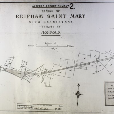
“Reifham St Mary with Kerdestone”, tithe alterations (altered apportionment 2), ref 1880/23/442, 25 November 1904, alterations due to the railway line.
“Reifham St Mary with Kerdestone”, tithe alterations, (altered apportionment 1), 1882
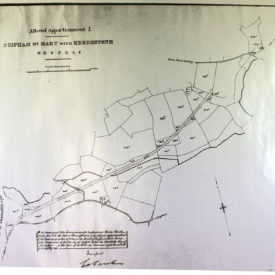
“Reifham St Mary with Kerdestone”, tithe alterations (altered apportionment 1), ref 1880/23/442, 30 November 1882, alterations due to the railway line.
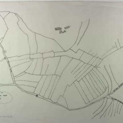
Map of Kerdiston, 1600s
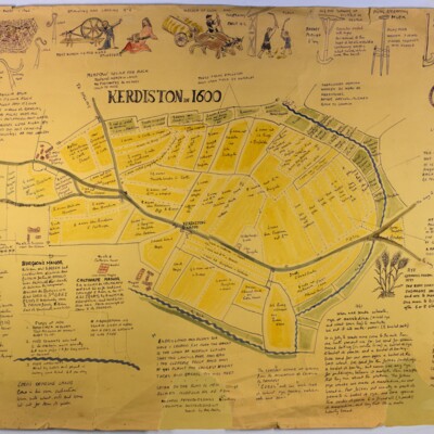
Probably drawn after May 1967; author/illustrator unknown, possibly Sally Aitchieson, who collected it. File includes a photocopy of a field map of Kerdiston showing the location of the map on a Norfolk Record Office 1577-1603 map of Reepham and…
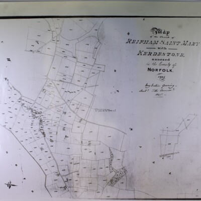
Map of Kerdiston, 1800s
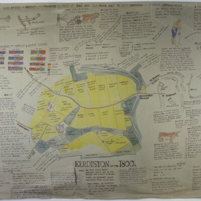
Copied after May 1967; author/illustrator unknown, possibly Sally Aitchieson, who collected it,
Map of Kerdiston, 1900s
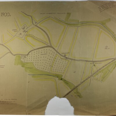
Space for one or more images, now missing, obviously removed, Copied after May 1967; author/illustrator unknown, possibly Sally Aitchieson.
Map of Salle parish, centre
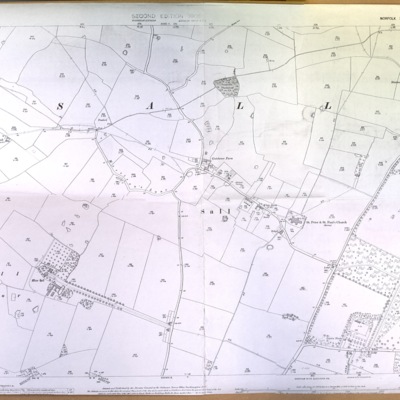
Copy of Ordnance Survey map, scale 1:2500, ref. XXXVIII-2
Map of Salle parish, east
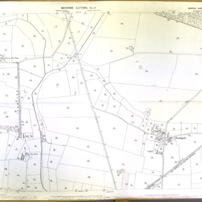
Copy of Ordnance Survey map, scale 1:2500, 1906, ref. XXXVIII-3, Salle Park to Southgate
Map of Salle parish, east, including Southgate
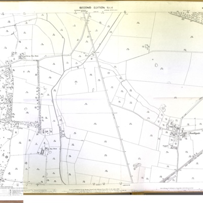
Ordnance Survey map, scale 1:2500, surveyed 1884
Map of Whitwell and Hackford, 1772
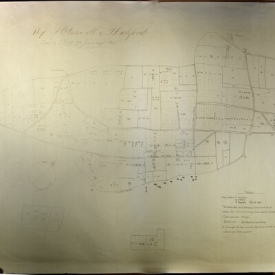
Copied by S King, 1772, copied from a rough plan
Ordnance Survey map of Booton, Brandiston and Cawston, 1957
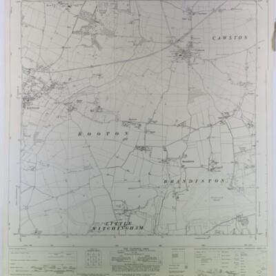
Ordnance Survey, 1957, ref. TG 12 SW, scale 1:10560
Ordnance Survey map of Booton, Brandiston, Cawston, 1957, showing rural district boundary, footpaths and bridleways
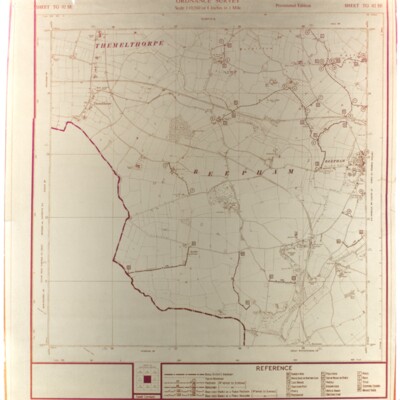
Ordnance Survey, 1957, ref. TG 12 SW, provisional edition, scale 1:1056
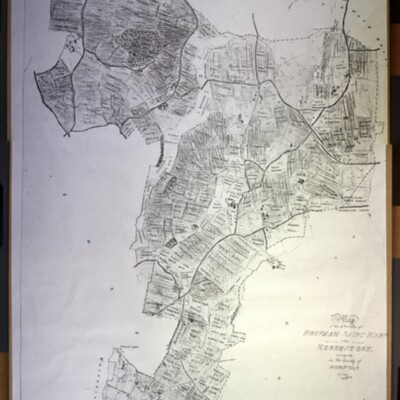
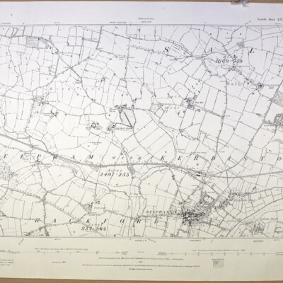
Ordnance Survey map of Reepham with Kerdiston 1907
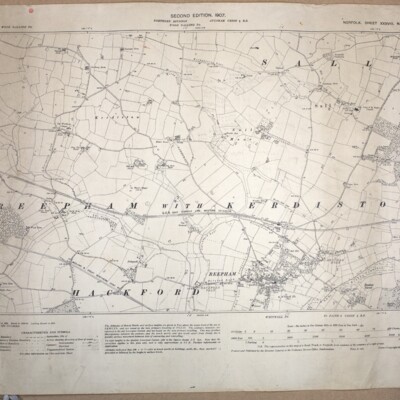
Ordnance Survey, scale 1:2500, 1907, Norfolk Sheet XXXVIII N.W., second edition, surveyed in 1884, revised 1904-05. Includes parts of Salle and Hackford
Ordnance Survey map of Reepham, 1891
Ordnance Survey, scale 1:2500, 1891, Norfolk Sheet XXXVIII N.W., surveyed in 1884
Ordnance Survey map of Reepham, north, 1975
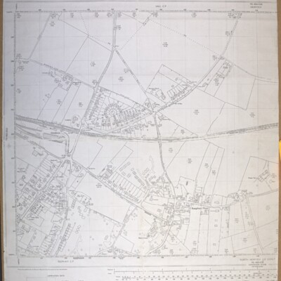
Ordnance Survey map, 1975, scale 1:2500, ref. TG 1023-1123
Ordnance Survey map of Reepham, north, 1990
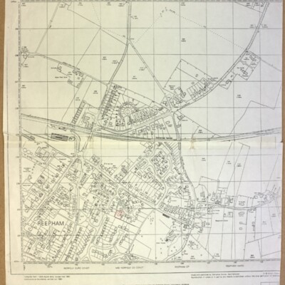
Ordnance Survey, revised March 1990, scale 1:2500, ref. TG 1023
Ordnance Survey map of Reepham, southeast, 1975
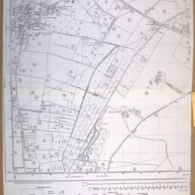
Ordnance Survey map, 1975, showing Bar Lane to Furze Lane, scale 1:2500, ref. TG 1022-1122.