
Browse Items (1009 total)
Sort by:
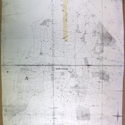
Wood Dalling tithe map, 1841
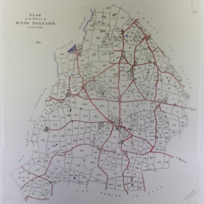
With owners’ list (not found) and slightly reduced tracing
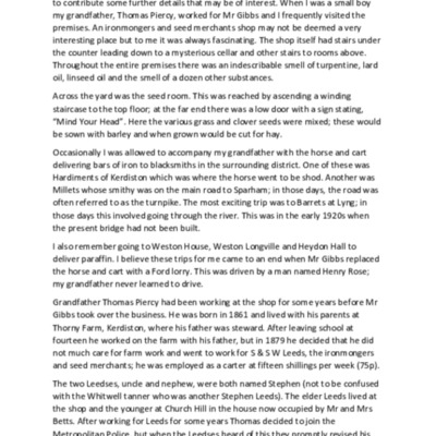
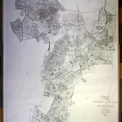
Map of Kerdiston, 1600s
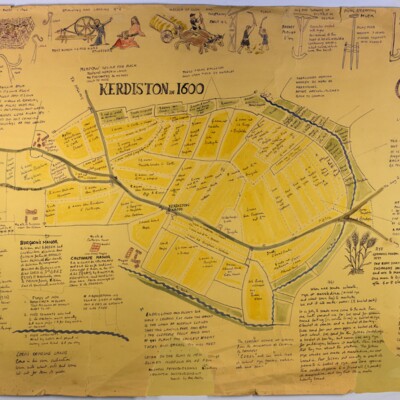
Probably drawn after May 1967; author/illustrator unknown, possibly Sally Aitchieson, who collected it. File includes a photocopy of a field map of Kerdiston showing the location of the map on a Norfolk Record Office 1577-1603 map of Reepham and…
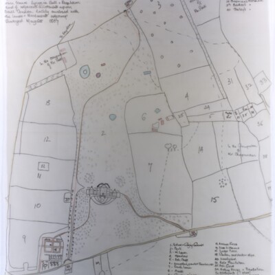
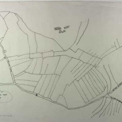
Map of Kerdiston, 1800s
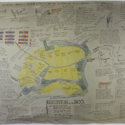
Copied after May 1967; author/illustrator unknown, possibly Sally Aitchieson, who collected it,
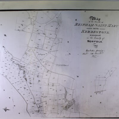
Map of Kerdiston, 1900s
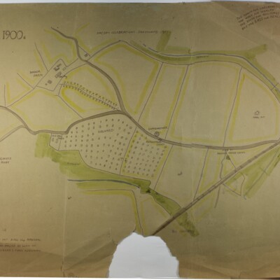
Space for one or more images, now missing, obviously removed, Copied after May 1967; author/illustrator unknown, possibly Sally Aitchieson.
Notes on Salle Church

Information on the church building with interior features described. Originally compiled by the head of of Reepham School (B.Wise?) in 1981 & re-issued in 1983 with foreword by David Rosenthal. The original 16pp version includes detailed historical…
Salle Estate, 1807
Plan of gardens, house, lands, etc., of Richard Paul Jodrell Jun. Esq. In his own tenure lying in Sall and Reepham and of adjacent allotments upon Sall Common, lately enclosed with lands and tenements adjoining. Surveyed 28 May 1807.
“Reifham St Mary with Kerdestone”, tithe alterations (altered apportionment 2), 1904
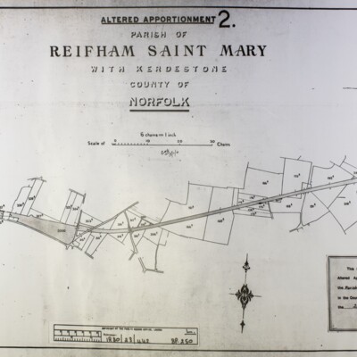
“Reifham St Mary with Kerdestone”, tithe alterations (altered apportionment 2), ref 1880/23/442, 25 November 1904, alterations due to the railway line.
“Reifham St Mary with Kerdestone”, tithe alterations, (altered apportionment 1), 1882
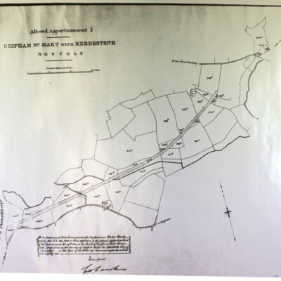
“Reifham St Mary with Kerdestone”, tithe alterations (altered apportionment 1), ref 1880/23/442, 30 November 1882, alterations due to the railway line.
Thurning Ordnance Survey map, 1906, showing Thurning Hall and Tyby
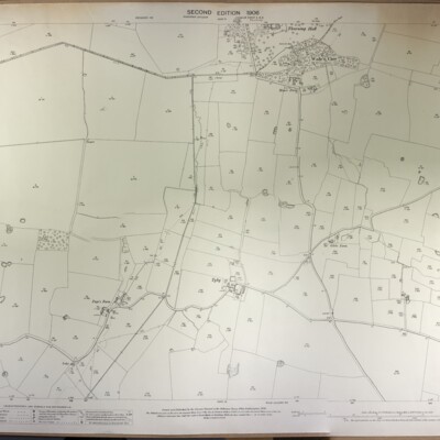
Thurning, Ordnance Survey, 1906, second edition, surveyed in 1884-85, revised in 1905, scale 1:2500, ref. Norfolk Sheet XXVII 9, showing Thurning Hall and Tyby.
Thurning Ordnance Survey map, 1906, showing Thurning Hall and church
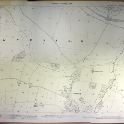
Thurning, Ordnance Survey, 1906, second edition, surveyed in 1885, revised in 1905, scale 1:2500, ref. Norfolk Sheet XXVII 5, showing Thurning Hall and church.
Wood Dalling Ordnance Survey map, 1978
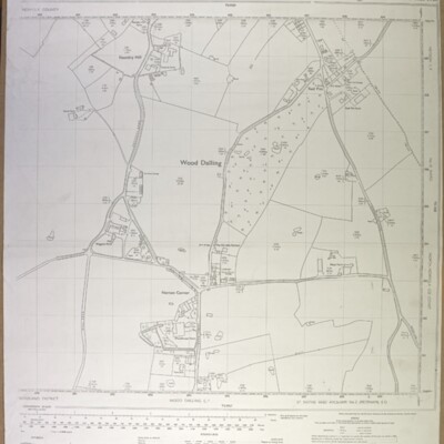
Wood Dalling centre (Norton Corner), Ordnance Survey, 1978, scale 1:2500, ref. TG 0828-0928
St Michael's Building Project

Report from EDP of St. Michael's revamp in 2010, plus 3-fold pamphlet explaining changes to be made. Further cutting from 2011 reporting on RIBA award made to Norwich's A Squared architects.
Whitwell, tithe map, 1844
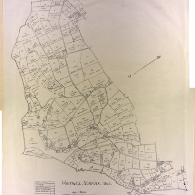
Original (not scanned) and tracing by Kate Nightingale
Whitwell Common, 1905
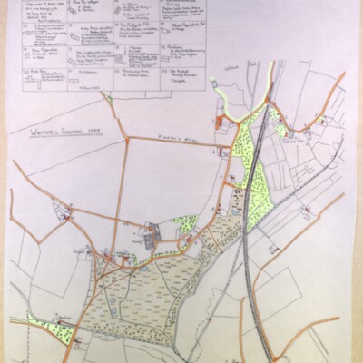
Tracing made by Kate Nightingale made 5 March 1993 of a map belonging to Mr Tony Ivins of Whitwell Hall. See also GB/REE/2108041645, Occupants of Whitwell Common Cottages in 1905 & 1971 by Ann Middlemas