
Browse Items (2 total)
Sort by:
Reepham St Mary & Kerdistone Tithe Map 1846
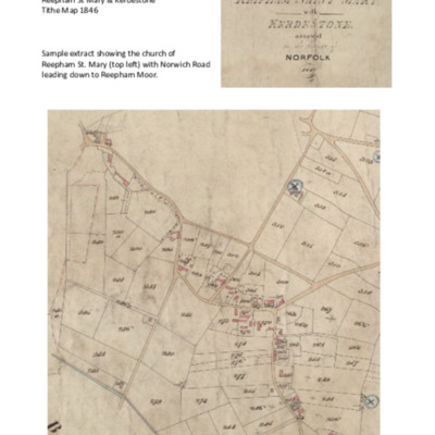
Sample extract from a digital copy of Reepham St Mary & Kerdistone tithe map with areas of land numbered.
Parts of the map have been copied & analysed many times & results of this work are stored in the Tithe Documents Collection.
A…
Parts of the map have been copied & analysed many times & results of this work are stored in the Tithe Documents Collection.
A…
Landowners in Reepham Parish 1846
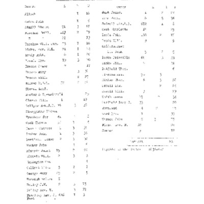
First page (reproduced here) gives landowners' names, acreage owned & use of that land.
Remaining faded pages list land in number order with owner, occupier, name of area (e.g. Burtons Pightle) & land usage. Information from Reepham St. Mary &…
Remaining faded pages list land in number order with owner, occupier, name of area (e.g. Burtons Pightle) & land usage. Information from Reepham St. Mary &…