
Browse Items (69 total)
- Collection: Norfolk Heritage Explorations
Sort by:
Norwich Road
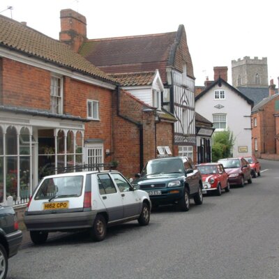
Row of cottages & shops on Norwich Road, looking towards the churches. Many were given new frontages in the nineteenth century. Beaver House is the nearest.
Norwich Road
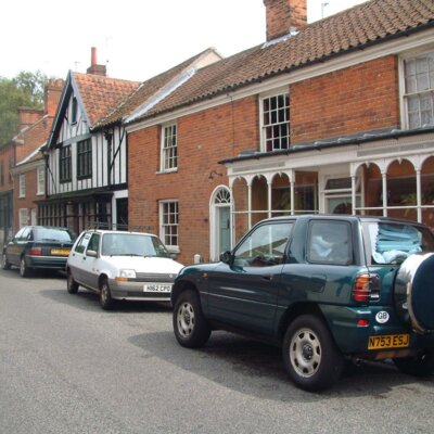
A further view of Norwich Road looking away from the town. Beaver House was a grocer & draper, and the Tudor style house belonged to a boot & shoe repairer.
The Bays & Swiss Cottage
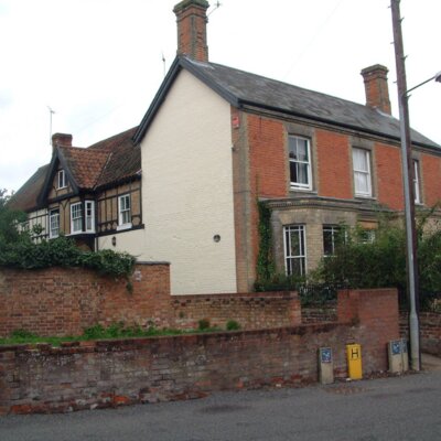
The Bays, on Norwich Road, stretches back into Swiss Cottage. The two houses are now separated but were extended from an earlier half-timbered house, largely hidden from the outside.
St. Mary's & St. Michael's
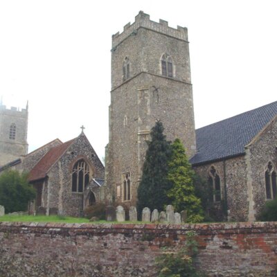
The two churches from Back Street. Note the height of the churchyard from the road.
Whitwell Hall
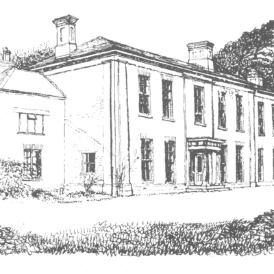
Drawing of the hall, once the home of the Leamon family.
Whitwell Hall
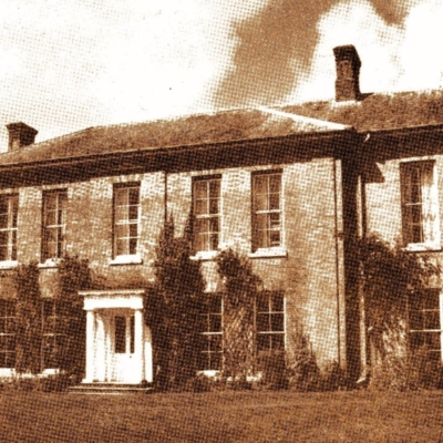
Twentieth century photograph of the hall. Currently an educational establishment offering camping & open air experiences to school pupils.
Austins Barn, Whitwell Street
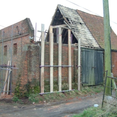
An 18th century barn being restored in 2004. Initials & date - WB 1785 - on the gable end, probably indicate that it was built & owned by William Bircham (c1735-1813).
Also known as Dairy Farm Barn.
Also known as Dairy Farm Barn.
Bar Lane
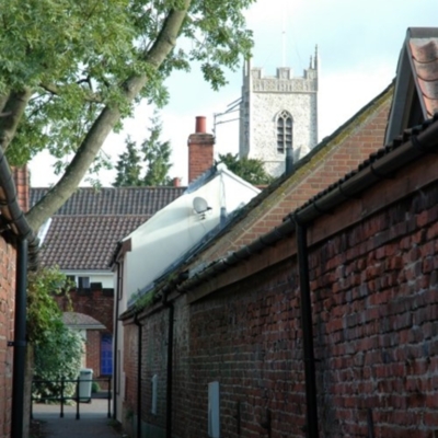
Bar Lane, previously known as Gracious Street (?) leads from Back Street to Whitwell Street.
The Sun Inn
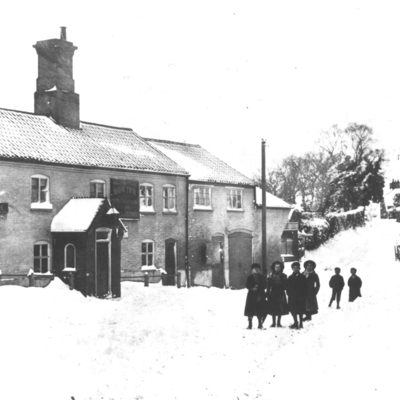
Early photograph of the Sun Inn in the snow, looking towards Towns End. The Market Room sign is visible, used for transactions on Market Day.
Sir Dymoke White
Sir Dymoke White used the bank in Reepham & relied on Gibbs for supplies of seed and feed. Photographed in the late 1940s.
Leeds Tannery
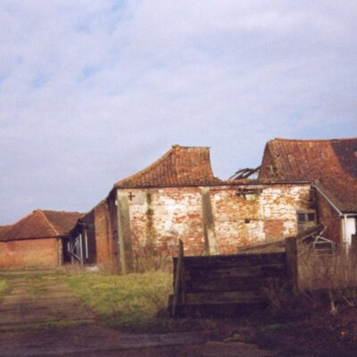
The remaining buildings of Leeds tannery in Whitwell. It was purchased by Major Timothy White in 1903 but ceased functioning soon after that date.
Colour photograph 190 x 130 mm also held. On reverse: Site of Leeds Tannery, Whitwell.
Colour photograph 190 x 130 mm also held. On reverse: Site of Leeds Tannery, Whitwell.
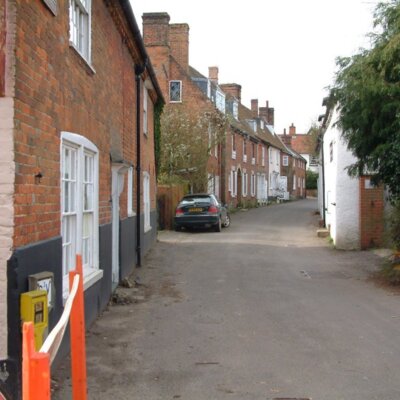
Back Street
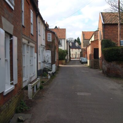
Modern view of Back Street looking towards Towns End.
Back Street
Modern view of Back Street with the Bar Lane archway & the house that was the Greyhound public house on the left.
Pulpit in St. Michael's
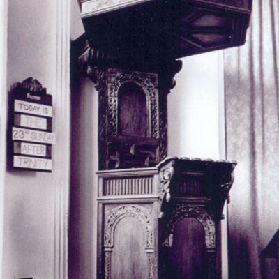
The Jacobean pulpit in St. Michael's church before the two churches were combined into one parish.
Booton Pill-Box
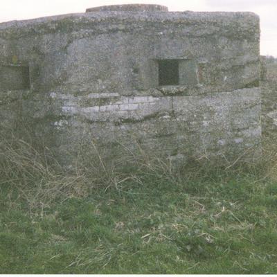
One of two pill-boxes erected as part of home defences in WWII. This one is (?) in the field on the way to Booton alongside the Norwich Road. A second one was built near Jordan Green.
Listed on Norfolk Heritage ExplorerNHER REF…
Dereham Road
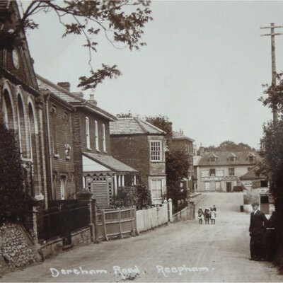
Postcard of Dereham Road looking towards the Market Place. Wallace King in evidence in Hackford House premises.
New Road
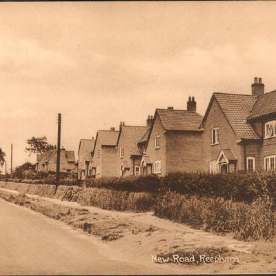
An early postcard showing a view of the houses on New Road looking towards Station Plain.
Tuck postcard RPHM 16
Tuck postcard RPHM 16
South Side of Reepham Market Place
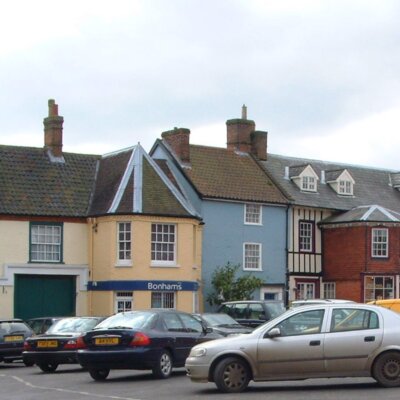
A view showing the south side of the Market Place from the King's Arms to the Sun Inn.
Reepham Town Sign
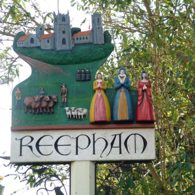
The sign was made by pupils from Reepham High School.
Porch Window of the Sun Inn
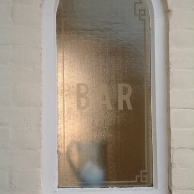
The Sun Inn now incorporates a shop as well as living space but the porch retains its original glass window.