
Browse Items (12 total)
- Collection: Tithe Documents
Sort by:
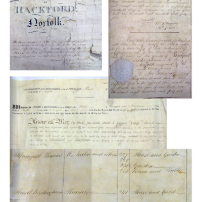
Hackford Tithe Apportionments
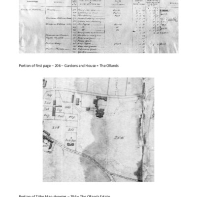
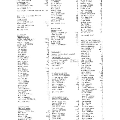
Copies of Hackford Apportionments Lists from Norfolk Record Office. Landowner names listed in alphabetical order beginning with William Bircham.
Beginning of list shown here with portion of related map showing 206-The Ollands Estate.These records…
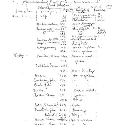
Landowners in Reepham Parish 1846
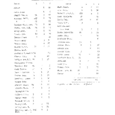
First page (reproduced here) gives landowners' names, acreage owned & use of that land.
Remaining faded pages list land in number order with owner, occupier, name of area (e.g. Burtons Pightle) & land usage. Information from Reepham St. Mary &…
Remaining faded pages list land in number order with owner, occupier, name of area (e.g. Burtons Pightle) & land usage. Information from Reepham St. Mary &…
Landowners in Hackford Parish 1844
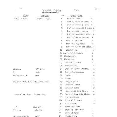
Land ownership listed in numerical order with owners, occupiers, area names & land usage.First page shown here.
Town Centre Tithe Map 1844
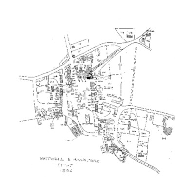
Photocopy of a portion of the original tithe map of Hackford next Reepham.
Sketch map of Reepham Town Centre copied from the tithe map for Hackford Parish, 1844, showing more clearly the numbers for each parcel of land. Can be linked to…
Sketch map of Reepham Town Centre copied from the tithe map for Hackford Parish, 1844, showing more clearly the numbers for each parcel of land. Can be linked to…
Hackford Next Reepham Tithe Apportionments 1844
List of landowners in alphabetical order, with occupiers, tithe numbers, land names & land usage. Earliest list of copies from tithe apportionment documents, probably made by Tony Ivins.Relates to Item “Hackford Tithe Apportionments”.First page…
17th Century Map
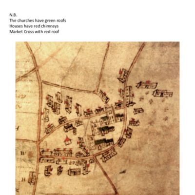
Photocopies of parts of a 17th century map of Hackford, Whitwell & Reepham, but does not include Reepham Moor or Kerdiston. It shows land in strips labelled with H, W & R representing each parish. On the colour copy some houses have chimneys shown…
Hackford Tithe Map & Apportionments Sample Page
A page of sample extracts from a complete digital copy of Hackford next Reepham tithe map & apportionments. The document was begun in 1844. Areas of land on the map are numbered and a list of landowners shows the land they owned & the names…
Whitwell Tithe Map & Apportionments Sample Page
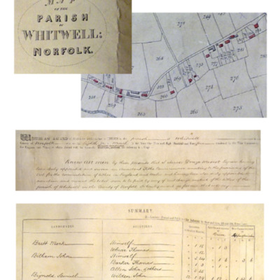
A page of sample extracts from a complete digital copy of Whitwell tithe map & apportionments. The document was begun in 1844. Areas of land on the map are numbered and a list of landowners shows the land they owned & the names of occupiers.…
Sketch Copy of Hackford Tithe Map
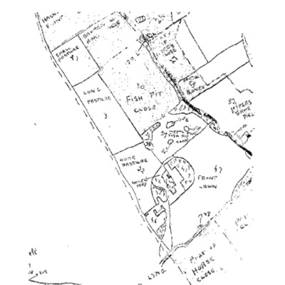
Very large copy of the tithe map for Hackford sketched & photocopied. Land area numbers have been given their names as they were known in the 1840s, e.g. 114 Marl Pit Meadow. Some details difficult to read
Eynsford Hearth Taxes 1666
Photocopies of entries from a book on hearth taxes for towns in Eynsford Hundred including the three parishes of Hackford, Reepham with Kerdiston & Whitwell. Familiar names appear, e.g. Dack, Coxfer, Gallant, Breese etc.
No indication of source.
No indication of source.
Summary of Land Ownership 1844
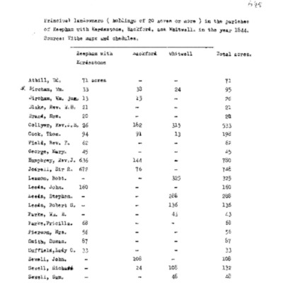
Landowners of more than 20 acres analysed from the tithe apportionment lists for the parishes of Reepham St. Mary with Kerdiston, Hackford & Whitwell.
Reepham St Mary & Kerdistone Tithe Map 1846
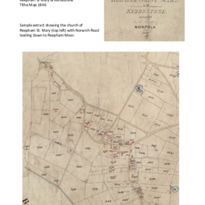
Sample extract from a digital copy of Reepham St Mary & Kerdistone tithe map with areas of land numbered.
Parts of the map have been copied & analysed many times & results of this work are stored in the Tithe Documents Collection.
A…
Parts of the map have been copied & analysed many times & results of this work are stored in the Tithe Documents Collection.
A…