
Browse Items (6 total)
Sort by:
Fairway Garage

View towards Reepham on the Cawston Road showing Fairway Garage and the water tower that stood near the junction with Orchard Lane.
Compulsory Purchase - B1145

Notice in the Eastern Daily Press dated 20 June 1990. The Norfolk County Council (Reepham, B1145 Station Road Improvement) Compulsory Purchase Order 1990.
This refers to the compulsory purchase of land along Station Road, Cawston Road, Wood…
This refers to the compulsory purchase of land along Station Road, Cawston Road, Wood…
Laburnum Grove, Reepham
View of Laburnum Grove and Cawston Road looking towards Cawston.
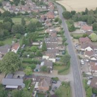
Changes to Cawston Road/Wood Dalling junction
Aerial photograph of the junction on the B1145 before modification in the 1990s
Cawston Road before B1145 modification
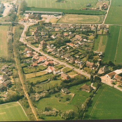
On the left can be seen the start of the Crown Meadow Development, the disused station and storage that later became Kerri's Pine. The railway bridge over Marriott's Way is now a footpath to Coller's Way. Bottom right can be seen Fairway Garage and…
Reepham Life Calendar 2015
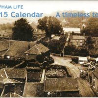
A4 format calendar with historical photographs and smaller modern colour photographs of the same view together with notes and page per month layout.