
Browse Items (23 total)
Sort by:
Malthouse - St Johns Alley
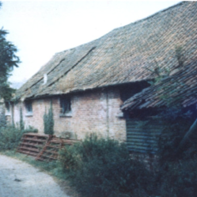
View of part of the malthouse/maltings building in St. John's Alley before changes were made.
From the entrance opposite the Spar shop in Ollands Road St. John's Alley leads past this now renovated part of the malthouse, emerging next to the post…
From the entrance opposite the Spar shop in Ollands Road St. John's Alley leads past this now renovated part of the malthouse, emerging next to the post…
Malthouse Demolition - Comments
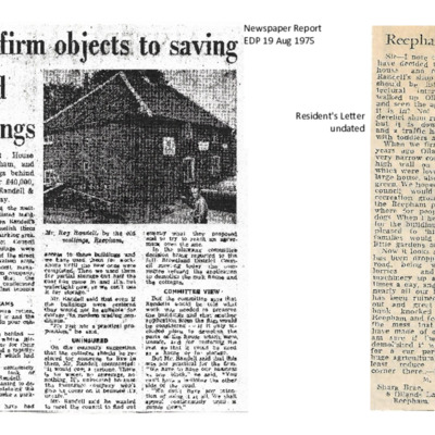
Newspaper reports and letters recording comments and arguments about Randell's proposed demolition of the malthouse/maltings & the two attached cottages. The plans in this file did not take place as proposed. Partial demolition took place…
Randell's Premises
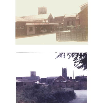
Two views of Randell's shopfront. Possibly early 1980s.
The top picture gives a closer view of the shopfront.
In the lower picture the Malthouse Cottages have been demolished. The wall of the malthouse/barn has been reduced & the lower windows…
The top picture gives a closer view of the shopfront.
In the lower picture the Malthouse Cottages have been demolished. The wall of the malthouse/barn has been reduced & the lower windows…
Malthouse Cottages- Ollands Road
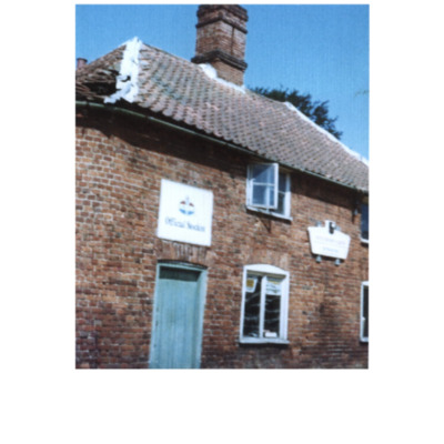
Malthouse Cottages at the bend on Ollands Road. Once used by Randell's.
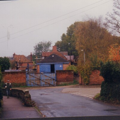
Malthouse on Ollands Road
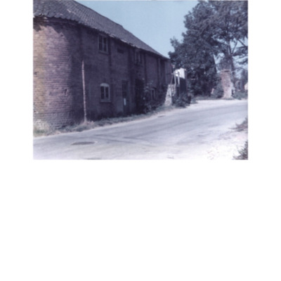
View of part of the malthouse/barn on the bend at the bottom of Ollands Road before any major demolition work took place.The lower half of the outer wall still exists. The windows were bricked in. A wide blue metal gate stands where the double doors…
Junction of Old Brewery Lane & Ollands Road
A view of the bend in Ollands Road before any new houses were built on the Spar side. The sign directs to the car park at the back of the Old Brewery House Hotel.
Three Views - Ollands Road
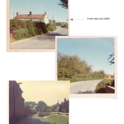
Three views of Ollands Road taken in the late 1960s (?). Two show the top of Ollands Road. Part of the sign for the Crown public house can just be seen at the edge on the right. A third view, looking down the road, showing part of buildings that were…
The Hollies
A view of The Hollies at the bottom of Ollands Road. The Church Walk in the Ollands grounds used to run alongside it. Modern houses have been built between it & Ollands Road.
Sir Dymoke White's Carriage & Four
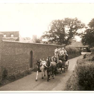
Sir Dymoke White's 4-in-hand carriage being driven up Ollands Road by Arthur (?) the coachman. The lady is possibly Ann Bircham. The Ollands wall clearly shown with garden buildings behind. Background shows the malthouse/granary with the outside…
Cottage in Ollands Road
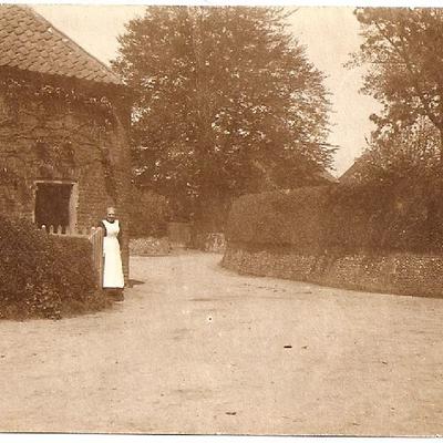
Lady named as Mrs. Wasey, at the gate of a cottage on the bend at the bottom of Ollands Road. The gate into the grounds of the Ollands House can be seen on the right. The two cottages backed onto the Maltings & were demolished in the 1970s. The last…
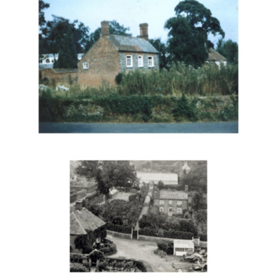
The Ollands Estate before Demolition

View of the house & orangery in derelict condition and a view of the wall that existed on Ollands Road, looking towards Echo Lodge
Echo Lodge
Echo Lodge, on Ollands Road, is the last remnant of the Ollands estate. Built as housing for the coachman.
Two Reepham Farriers
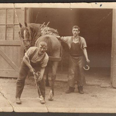
The two farriers are believed to be Walter Rudd and A. Lock. The blacksmith's was at the corner of Ollands Road and Malthouse Yard, part of Eglington's yard.
John and Mary Kendrew
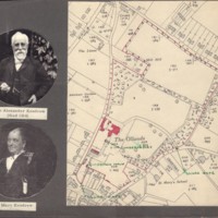
John Anthony Kendrew (died 1914) and his wife Mary, with a map of the house and grounds of Ollands House.Label should say John Anthony Kendrew rather than John Alexander.
Booton Post Mill
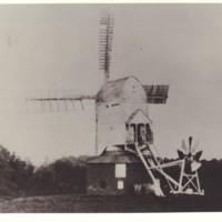
Booton Windmill, originally situated on Windmill Hill in Mill Lane, off Ollands Road, is shown working there on the 1844 Tithe map. It was moved to Booton Hill in 1903 (some sources say it was demolished in 1890) and this photograph was taken in…
Ollands Road 1997
View down Ollands Road looking towards the churches.
Old Brewery Lane on the right.
Old Brewery Lane on the right.
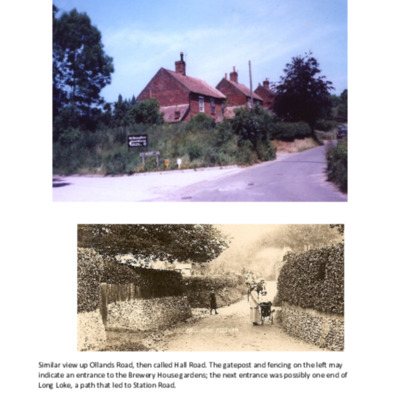
Hall Road (now Ollands Road) in 1920s
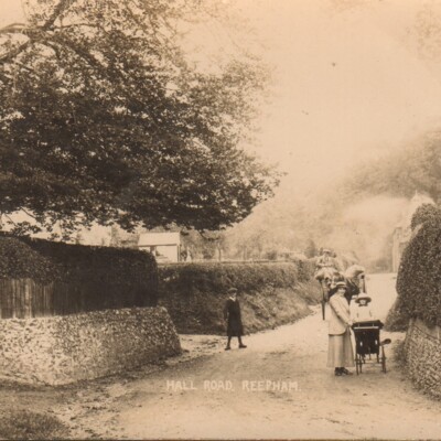
Original postcard marked Hall Road, Reepham. On the reverse:-Ollands Road, Reepham, NorfolkMiss Anne Bircham (in pram)Nursemaid Dorothy Basham?Mr Symonds in cart, (Evan Symonds Father)Mrs. Dick Hatley. (Dates : Anne Bircham was born in 1913)Two…
Aerial View of Reepham
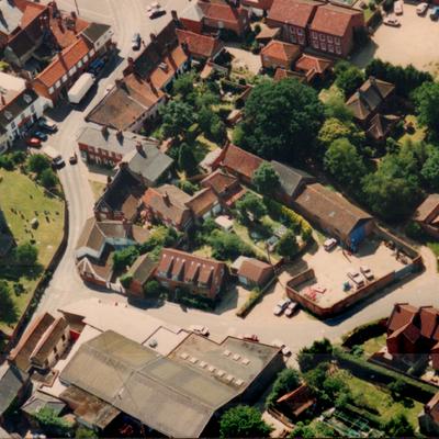
Photograph showing Randell’s workshops and showrooms, now Spar and Malthouse Yard, the site of Wilkins Mills, the Bircham's Brewery and the car park of the Old Brewery House Hotel.
Ollands Road with Maltings
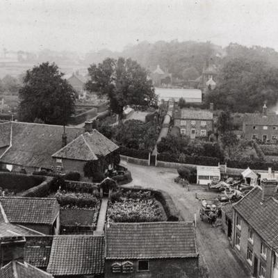
View showing The Maltings on the left and Eglington's Yard (later Randell's) to the right. Clear view of the footpath to Ollands House via a large greenhouse.
Mill Hill Academy, Ollands Road
Notes on the life of Orlando Cooper who ran a school called Mill Hill Academy on Ollands Road.